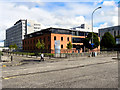
Area Overview for Glasgow City
Photos of Glasgow City


Area Information
Living in Glasgow City offers a life defined by its historic urban core and wide-ranging local authority jurisdiction. You are residing within a district that spans 176.4 km², encompassing everything from dense city-centre living to suburban extensions. This area serves as the administrative heart of the region, functioning as a unitary authority where local services are managed centrally. Daily life here varies significantly depending on your specific neighbourhood, yet the defining characteristic remains the scale of the territory you call home. The area is not merely a collection of streets but a comprehensive borough that shapes how residents navigate their environment and access public services. Whether you are commuting from the outskirts or living centrally, the boundaries of Glasgow City influence your immediate surroundings. The sheer size of 176.4 km² means that infrastructure covers a vast range of landscapes. You will find that your daily routine is coloured by this extensive local governance structure. Understanding the full span of the district helps you appreciate the diversity of locations within this single administrative zone. It is a place where local decisions impact a wide population across a significant geographical footprint.
- Area Type
- District/Borough
- Area Size
- 176.4 km²
- Population
- Not available
- Population Density
- Not available
Demographics
The community profile of Glasgow City reflects a large, established population with specific housing characteristics. You will find a mix of residents adapting to a landscape dominated by a specific accommodation type. The area features distinct patterns of home ownership and renting that define the social fabric. Without specific age or household type figures in the current dataset, the operational reality focuses on the structural makeup of the homes. The dominant feature of the housing stock determines who can move in where you choose to live. The level of deprivation in the area is not currently quantified in the available information for this specific report. This absence of specific deprivation data means you must assess quality of life through other tangible indicators of the community. The diversity of the population exists alongside a housing market that leans heavily toward tenanted properties. Residents navigate a region where rental arrangements often supersede ownership. You are part of a community shaped by these visible structural realities rather than detailed census breakdowns. The character of Glasgow City is built on this foundation of accommodation types and occupancy rates.
Household Size
Accommodation Type
Tenure
Ethnic Group
Religion
Household Composition
Age
Household Deprivation
NS-SEC
Explore more demographic insights in this area
Go to Demographics tabPlanning
Planning Constraints
- Flood RiskPremium
- Ramsar Wetland SitesPremium
- Area of Outstanding Natural BeautyPremium
- Protected Nature ReservePremium
- Protected WoodlandPremium
- Crime RiskPremium